Government projects today are becoming more advanced, more regulated, and more demanding in terms of accuracy and transparency. Once manageable mistakes now lead to huge financial losses and delays. For this reason, many governments around the world are adopting Scan to BIM as a mandatory requirement. This process captures accurate building details and converts them into highly intelligent 3D digital models for planning, design, coordination, and monitoring.
In this detailed blog post, you will clearly understand why Scan to BIM is now essential, how the process works, and how it solves real problems in government construction projects.
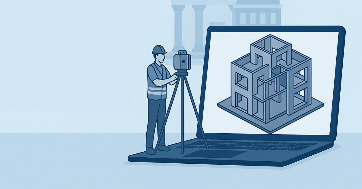
What Is Scan to BIM?
Scan to BIM is a modern technique in which survey teams use 3D laser scanners to capture an entire building, bridge, tunnel, or construction Site. These scanners create a highly accurate point cloud, which acts like a 3D digital copy of the real world. Experts then convert this point cloud into a BIM (Building Information Model) that can be used in software such as Revit.
Unlike manual measurements, which often contain human errors or missing details, this process captures everything—from walls and beams to pipes and ceilings—with millimeter-level precision. Governments prefer it because it eliminates guesswork and provides a dependable foundation for design, renovation, and construction work.
The beauty of Scan to BIM is that it allows government authorities to understand a building’s true condition without even stepping onto the Site. With a complete 3D model at their fingertips, decision-makers can rotate, zoom, and analyze different parts of the structure from their office. This improves planning and removes the need for multiple Site visits.
The model also stores important data that helps engineers understand structural stability, MEP routing, material conditions, and future risks. This makes the entire workflow smoother and safer.
Why Governments Are Making Scan to BIM Mandatory
Governments do not make new rules without strong reasons. When they choose to make Scan to BIM mandatory, it’s because it solves long-standing problems such as project delays, cost overruns, safety risks, and the lack of accurate documentation. Public projects involve huge budgets and strict accountability, so every stage must be handled carefully.
In many countries, audit officials have discovered that outdated drawings, poor measurements, and miscommunication between teams were causing major losses. Scan-to-BIM solves these issues by creating a reliable digital foundation for every project.
Government projects also involve multiple stakeholders—engineers, architects, contractors, consultants, inspectors, and policy makers. Everyone needs clear and accurate information, or misunderstandings can delay the project.
Scan to BIM provides one universal source of truth that all teams can rely on. This prevents disputes and misaligned designs. Governments also appreciate that digital models from Scan to BIM can be stored permanently as part of the national digital infrastructure, helping future administrations maintain or renovate projects without having to start from scratch.
1. It Improves Accuracy and Reduces Errors
Accuracy is one of the biggest reasons Scan to BIM is becoming mandatory. Laser scanners capture millions of data points, making sure every measurement is precise. Human measurements often lead to errors, especially in old, complex buildings where walls are not perfectly straight or rooms are irregular.
With Scan to BIM, the government receives an accurate 3D representation of the building, enabling engineers to design confidently without worrying about measurement errors. This dramatically reduces costly rework later.
Even a small measurement error—such as a mis-measured column or misplaced pipe—can cause major structural or MEP coordination problems. When public funds are involved, the government cannot afford such risks.
Scan-to-BIM eliminates guesswork and provides real-world data that matches the building perfectly. This is important for heritage buildings, railway stations, airports, and bridges where precision is crucial. With reliable data, the planning team avoids costly surprises, design clashes, and material waste. It ensures that every decision is based on factual, verified information.
2. It Speeds Up Renovation Projects
Most government buildings are old, and their drawings are either outdated or missing. Renovating these structures can be slow because architects and engineers lack accurate information. Scan-to-BIM speeds up renovations by providing a complete understanding of the Site instantly.
The detailed BIM model helps professionals plan changes, identify issues, and prepare construction documents more quickly. This reduces downtime and allows projects to progress smoothly.
Renovations often require multiple inspections, especially when dealing with hidden pipes, cables, beams, or damaged sections of the structure. Manual surveys take months and are still not 100% accurate. Scan to BIM enables the government to complete the entire scanning process in a few hours or days, depending on the building’s size. This shortens the project timeline significantly. The BIM model also highlights areas that need repairs, safety upgrades, or structural reinforcement. This helps teams plan smarter, avoid delays, and reduce unnecessary Site visits.
3. It Reduces Project Costs
Government projects often exceed the budget due to errors, delays, and poor planning. Scan to BIM helps reduce costs by improving accuracy and reducing rework. A single measurement error can trigger costly delays, but with accurate BIM models, this risk is eliminated.
Additionally, quantity estimation becomes more accurate because the BIM model includes real dimensions.
By using Scan to BIM, governments can also reduce the cost of manual surveys and repeated Site inspections. The precise model eliminates the need for multiple verification visits, which saves time and transportation costs.
Additionally, contractors experience fewer clashes during construction since the model allows pre-coordination of all systems. This prevents expensive rework and material waste. Governments can also negotiate contracts more effectively because the exact scope of work becomes transparent, helping avoid inflated estimates or hidden costs.
4. It Helps in Better Planning and Coordination
Government projects involve many teams, and each team depends on correct information to do its work properly. When everyone uses the same BIM model, coordination becomes seamless. Designers, structural engineers, MEP teams, and contractors can collaborate in real time.
This reduces confusion and improves communication, resulting in better planning and execution.
Many government projects are delayed because teams use different sets of drawings, often leading to mismatched designs or unclear instructions. With Scan to BIM, everyone sees the same 3D model, making coordination much easier.
Any clash or conflict—such as a duct passing through a beam – can be detected early, long before construction begins. This prevents costly mistakes on-site. BIM also allows teams to run simulations, review structural behavior, test fire safety systems, and evaluate energy performance. This creates a well-planned, well-coordinated project from start to finish.
5. It Supports Digital Transformation Goals
Governments worldwide are adopting digital technologies to increase efficiency. Scan to BIM aligns with these goals by providing digital records that support modern construction workflows.
With BIM models, governments can store data, track progress, and plan maintenance activities more easily. It helps them move towards transparent, technology-driven infrastructure development.
As nations move toward smart cities and digital governance, having a digital version of every public building becomes essential. Scan to BIM acts as the foundation of this digital transformation. It allows governments to integrate BIM models with sensors, IoT devices, and facility management systems. This helps monitor building conditions, predict maintenance needs, and evaluate the performance of public infrastructure. It also supports disaster planning, assisting authorities to assess structural integrity during emergencies such as earthquakes, floods, or fires. This future-proof approach strengthens national infrastructure.
6. It Ensures Transparency in Public Projects
Government projects must be transparent because they use taxpayer money. Scan-to-BIM makes the entire construction process more transparent by providing accurate documentation and visual evidence of work.
Officials, auditors, and citizens gain more confidence when they see clear digital records and progress reports.
Scan to BIM models also act as solid proof against corruption, fraud, or mismanagement. Since the actual Site conditions are captured digitally, contractors cannot misreport work or hide missing activities.
Every update can be compared directly with the BIM model and point cloud scans. This level of transparency builds trust between the government and the public. It also helps auditors track costs, verify completed work, and ensure compliance with safety and building regulations. In this way, Scan to BIM strengthens accountability and public confidence.
7. It Simplifies Facility Management After Construction
After construction is completed, the government must manage and maintain the building for many years. Scan to BIM helps create a permanent digital record that contains structural details, MEP layouts, and maintenance data.
This makes repairs and future renovations much easier and faster.
In traditional projects, facility managers struggle due to missing or incomplete documentation. They often guess where pipes or cables are located, which increases maintenance time and risks accidental damage.
With Scan to BIM, they have complete visibility of the building’s internal systems. They can quickly identify issues, plan repairs, and avoid unnecessary breakdowns. The digital model also helps calculate maintenance costs, track asset life cycles, manage space planning, and schedule periodic inspections. This ensures the building remains safe and efficient for decades.
Read: Solar Farms and the Price Tag of Clean Energy: New Study Reveals 5% Dip in Nearby Home Values
How Scan to BIM Works in Government Projects
The Scan to BIM workflow typically includes Site scanning, processing point cloud data, creating the BIM model, and coordinating with stakeholders. Each step plays an important role in ensuring accuracy.
Government agencies follow strict guidelines to ensure the model meets national standards for BIM documentation. This ensures uniformity and quality across all public projects.
Many governments also require that all BIM models be delivered in specific formats, such as IFC or native Revit files, to ensure compatibility with future upgrades. This ensures that the BIM files remain usable even 10 or 20 years later.
Scan to BIM also supports phased construction and renovation by allowing authorities to compare past models with current conditions. By following a systematic workflow, the government can monitor every step and ensure the final model meets accuracy requirements, complies with guidelines, and supports long-term facility management.
Step-1: Laser Scanning the Site
In this step, professionals use advanced scanners such as Faro, Leica, or Matterport to capture the entire Site. These scanners produce a point cloud, which is a digital replica of the Site.
This method ensures that every corner of the building is documented accurately, even in hard-to-reach areas.
Laser scanning is much faster than manual surveying. A building that would take weeks to document manually can be scanned in a single day. This is valuable for government facilities such as airports, metro stations, and hospitals, where downtime is costly. Scanners also capture color data, textures, and geometric information that help create a realistic model. The captured point cloud serves as the foundation for the entire BIM model, so the quality of the scan plays a major role in achieving the required accuracy.
Step-2: Point Cloud Processing
After scanning, the point cloud data is cleaned and aligned. This ensures the point cloud is accurate and ready for modeling.
Specialized software is used to remove noise, adjust alignment, and ensure the data matches the real-world structure.
Point cloud processing is also where multiple scans are merged. Since large buildings require multiple scanning positions, the software stitches the scans into a single unified model. This stage is crucial because even a small misalignment can create major errors in the BIM model.
Experts also classify or segment different parts of the building, such as walls, doors, slabs, and structural columns. This organized point cloud speeds up and improves the modeling stage, supporting a smoother workflow for government projects.
Step-3: Creating the BIM Model
Once the point cloud is ready, experts convert point cloud to 3D Revit model. This process is known as Point Cloud-to-Revit Model Conversion.
The model includes architecture, structure, and MEP elements.
This step requires skilled BIM modelers who understand both engineering and software tools. Modelers follow government standards for LOD (Level of Detail), ensuring the model meets the required accuracy. All elements-walls, windows, columns, ducts, pipes, and beams0-are modeled carefully to match the point cloud. This digital model becomes the single source of truth for all future work. Some governments also require coordination models that combine all disciplines (Architecture, Structure, and MEP) to prevent clashes or conflicts in design.
Step-4: Review and Coordination
Once the model is ready, different teams review it. Engineers, architects, consultants, and government officials analyze the model to verify accuracy.
Any conflicts or issues are resolved before construction.
This stage often involves coordination meetings where teams examine the model together. Using BIM tools such as Navisworks or Revit, they identify clashes, assess structural integrity, evaluate MEP pathways, and confirm design compatibility.
Early detection of problems saves the government significant time and money during construction. Officials also use the model to assess compliance with regulations, safety codes, and building standards. Once approved, the model officially becomes the base plan for construction or renovation.
Benefits of Scan to BIM for Government Projects
Scan to BIM offers several benefits, such as accuracy, time savings, better collaboration, and improved documentation. It is especially useful for renovating old government buildings that lack reliable drawings.
Governments also appreciate that Scan to BIM reduces risks associated with outdated information. Building documentation becomes more organized, accessible, and easy to share between departments. Realistic 3D visualizations help teams better understand complex structures.
Whether planning electrical upgrades, structural reinforcements, or space optimization, the model supports all decision-making processes. The government can also simulate energy use, test fire safety, and evaluate accessibility for individuals with disabilities—all using the same BIM model.
1. Improved Public Safety
Public safety is a top priority for government projects. Scan to BIM helps improve safety by providing accurate information about structural elements, fire systems, and evacuation paths.
The BIM model also helps identify hidden risks in old buildings, such as weakened beams, outdated electrical wiring, or damaged plumbing. By analyzing these issues in advance, engineers can propose solutions before they become dangerous.
Governments can also use BIM models to simulate emergency scenarios, thereby improving evacuation routes and fire management systems. This proactive approach greatly reduces the chances of accidents and ensures buildings remain safe for public use.
2. Better Management of Old Buildings
Many government buildings are decades old. Their original drawings may be missing or incorrect. Scan to BIM solves this problem by creating a fresh set of accurate digital documents.
Old buildings often have irregular layouts, structural damage, or outdated systems that require careful handling. Scan to BIM allows authorities to understand these details without physically dismantling walls or ceilings. This reduces the risk of accidental damage during inspections. Governments can use the model to plan restorations, improve structural strength, upgrade utilities, and ensure the building meets modern safety standards-all while preserving historical or architectural value.
3. High Productivity in Large-Scale Projects
Government projects such as highways, airports, metro stations, and hospitals are massive in scale. Managing these projects requires efficiency and precision. Scan to BIM increases productivity by providing a digital baseline for planning, designing, and coordinating work.
Large-scale projects often involve hundreds of workers and dozens of vendors. Without a centralized model, communication becomes difficult and disorganized. The BIM model brings everyone together, allowing real-time collaboration.
Engineers can check structural alignment, contractors can plan schedules, and inspectors can verify compliance using the same model. This level of integration speeds up workflows, reduces confusion, and ensures the project moves forward smoothly without delays or miscommunication.
4. Supports Smart City Missions
Smart cities require accurate data and digital records of all infrastructure. Scan to BIM supports this mission by providing detailed 3D models of government buildings and public spaces.
In a smart city, digital infrastructure is just as important as physical infrastructure. Scan to BIM provides the digital framework for integrating smart systems, such as IoT-based monitoring, automated lighting, energy management, and security systems.
Governments can also connect BIM models with GIS platforms to visualize city-wide data in real time. This integration supports better urban planning, helps reduce traffic congestion, improves emergency response, and enhances overall governance.
5. Helps with Environmental Sustainability
Sustainability is another major focus of government projects. Scan to BIM helps reduce waste, improve energy efficiency, and support eco-friendly designs.
By using BIM models, governments can run energy simulations to see how much electricity a building will use, where heat loss occurs, and which materials offer the best insulation. This helps them choose sustainable design solutions.
Scan to BIM also reduces construction waste by providing accurate material estimation. It prevents unnecessary demolition and encourages recycling of existing materials. With detailed visibility, architects can also design buildings that maximize natural light and ventilation, reducing long-term energy consumption.
How Scan to BIM Improves Decision-Making
Scan to BIM improves decision-making by providing accurate, visual, and data-driven insights. Decision-makers no longer depend solely on Site visits or paper drawings. Instead, they can evaluate the whole project digitally.
Government officials often juggle multiple projects at once, making it difficult to visit each Site in person. Scan to BIM allows them to inspect the building virtually at any time. The model helps them understand how designs will impact safety, accessibility, cost, and long-term maintenance. Authorities can also compare different design options using the same model, making decisions more informed and strategic. This speeds up approvals and ensures projects move forward smoothly.
Challenges in Government Projects Without Scan to BIM
Without Scan to BIM, government projects face several challenges, such as inaccurate drawings, unclear documentation, repeated errors, and unpredictable outcomes. Manual methods are slow and unreliable.
In many cases, outdated 2D drawings do not match the actual Site conditions. This leads to confusion between architects, engineers, and contractors. Without precise data, teams may design solutions that clash with existing structures, causing costly rework.
Additionally, manual surveys cannot accurately capture hidden structural issues or MEP pathways. This increases the risk of unexpected delays and budget overruns. Governments face difficulty monitoring progress, inspecting work quality, and ensuring compliance without digital models.
The Future of Scan to BIM in Public Construction
The future of Scan to BIM in government projects is extremely promising. Experts predict that more countries will adopt mandatory BIM standards and advanced scanning technologies.
Emerging technologies such as drones, AI-based automated modeling, and digital twins will make Scan to BIM even more powerful. Governments will be able to manage entire cities digitally, monitor building health in real time, and predict maintenance needs before failures occur. Cloud-based collaboration will allow faster communication between departments. Public projects will become safer, cheaper, and more efficient as Scan to BIM becomes the global standard for construction and infrastructure management.
Final Thoughts
Scan to BIM is becoming mandatory in government projects because it improves accuracy, reduces costs, increases safety, and enhances transparency. It empowers governments to manage public infrastructure more effectively, reduce risks, and support long-term digital transformation. With the world moving towards smarter cities and digital governance, adopting Scan-to-BIM modeling is not just an option – it is a necessity.